
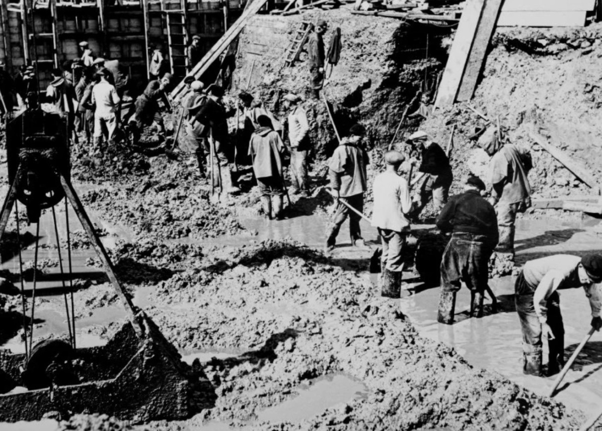
During World War Two the German Armed Forces put an immense effort in constructing fortifications and defense lines. Tens of thousands of bunkers, casemates, trenches, anti-tank walls and obstacles, tunnel systems and factories were built in the five years of war in Europe. Probably the best known of all is the construction of the Atlantikwall.
Although the name falsely suggests it was a single structure, which works really well in propaganda, it was actually comprised of thousands of individual fortifications and constructions that formed the base of a defense system that stretched along the West Coast of Europe. Even today it is very common to find remnants of these constructions in the European landscape.
Documenting bunker construction
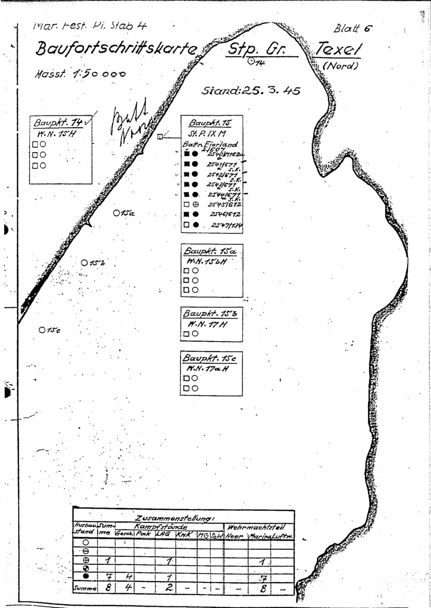
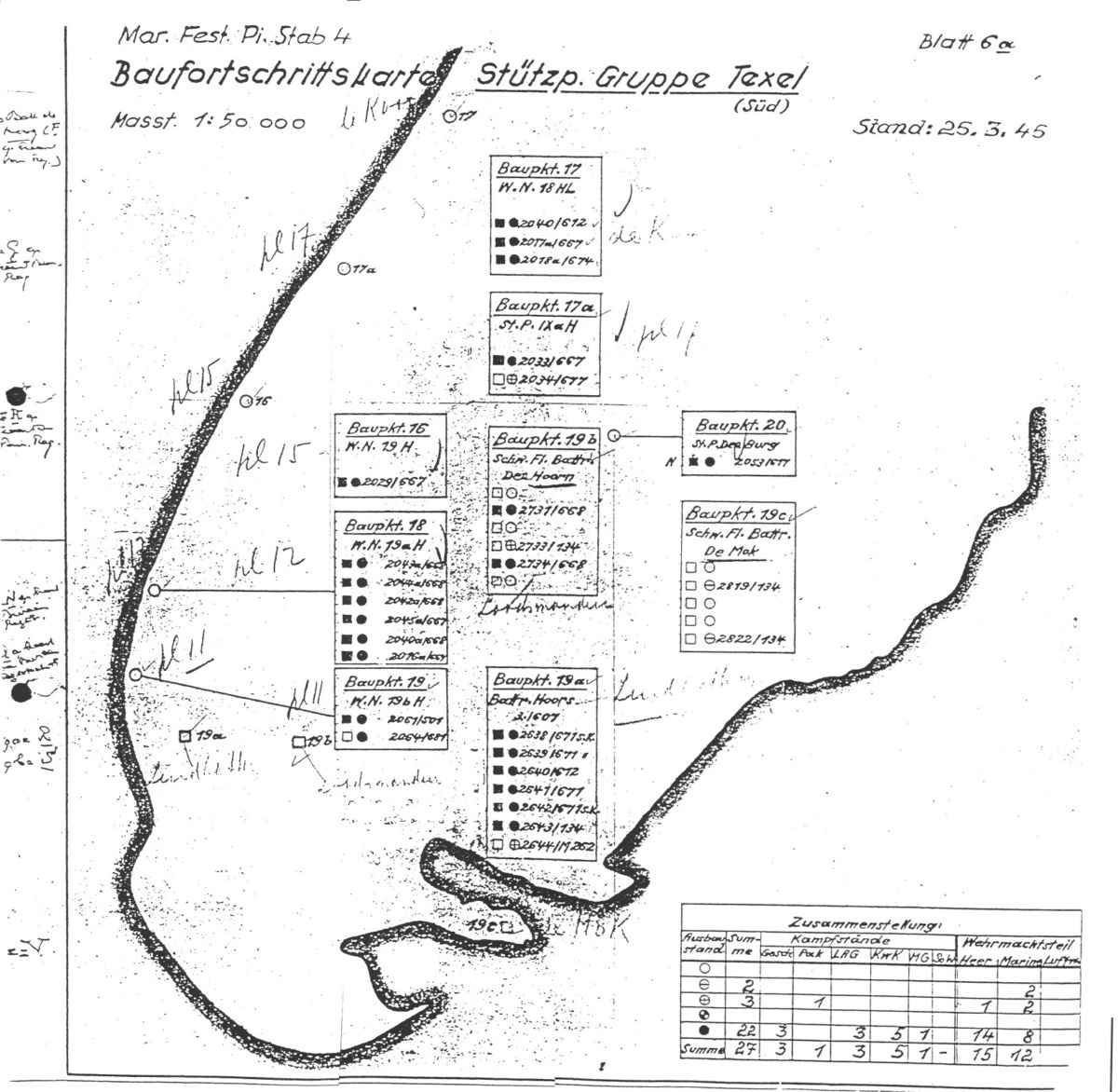
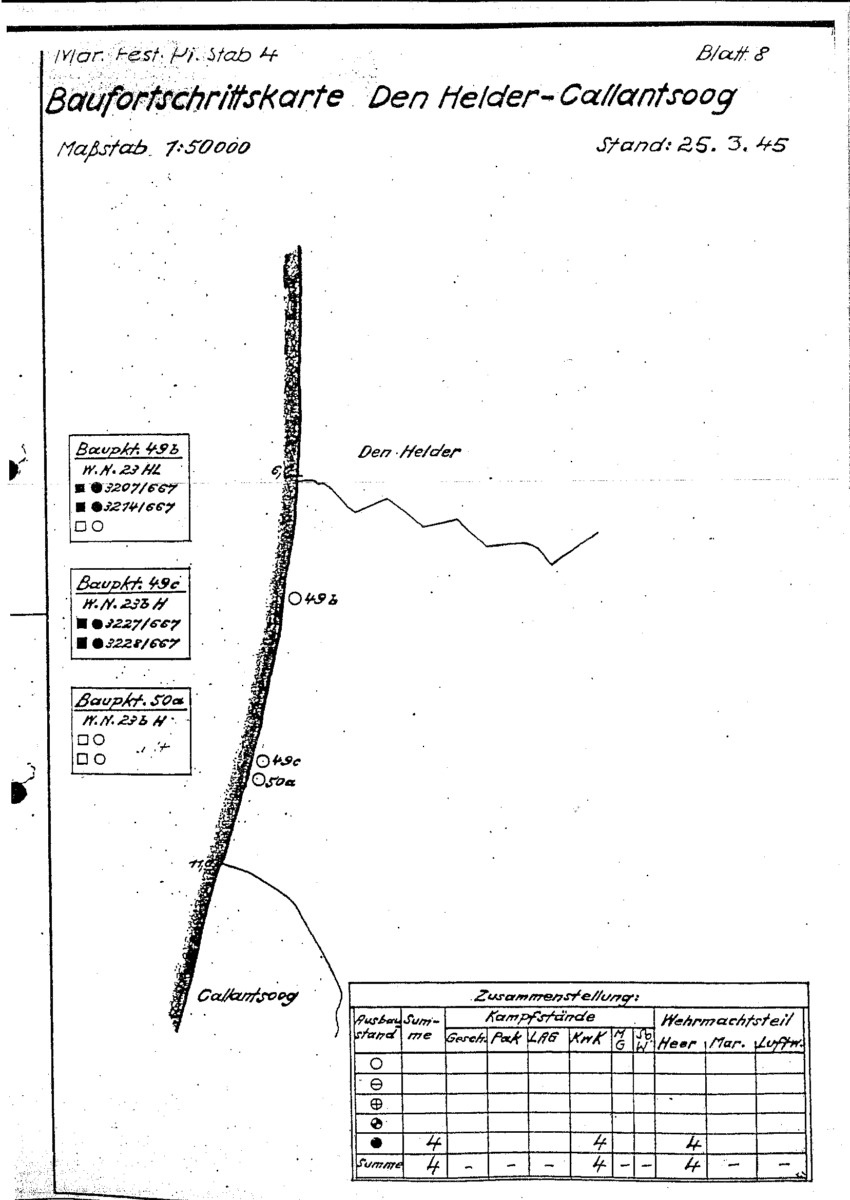
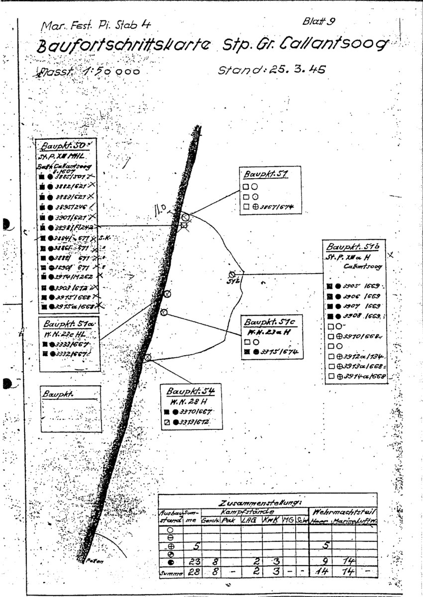
During the war the German Army made regular status reports and maps of the construction progress that were filed for administrative purposes. These reports are known as Baufortschrittsmeldung or Baufortschrittskarte. A map would typically show the complete plan of the position or fortification and list the individual bunker types to be constructed together with their construction status.
It is good to note that not every construction was documented in the reports. Sometimes additions or whole constructions were made by the units who manned the position themselves and were left undocumented.
Fortress Engineers
The administration of the reports and maps was the task of the Fortress Engineers or in German; Festung Pioniere. These were divided into different “Festung Pionier Stäbe” (Eng: Staff). Since the German Army had a strict divide between its Wehrmacht, Navy and Air Force organizations, these all had their own fortress engineer units. So for the German Navy these would be called Marine Festung Pionier Stab.
Baufortschrittskarten
These Baufortschrittskarten and Baufortschrittsmeldungen are a rich source of information for anyone interested in WW2. This is why we have shared our collection for your convenience. If you happen to have BFK’s not listed here, please share them with us so we can expand our collection further. Feel free to send us a message through our contact form.
The Netherlands
Most of the “Baufortschrittskarte” maps of The Netherlands come from the reports of Marine Festungs-Pionierstab 4 and Marine Festungs-Pionier Gruppe Wassenaar. After the war these reports were archived by the Dutch BRV administration, loosely translated as Bureau for Registration of Defense Works.
Marine Festungs-Pionierstab 4
Most of the Mar. Fest. Pi. Stab 4 reports are dated March 25th 1945, near the end of World War Two in Europe. At that time the Allied advance already reached the South of The Netherlands. The reports listed here are ordered from the North to the South and you can see that on some the reports covering the South certain areas are marked “Vom Feind Besetzt!”, which translates to “Occupied by the enemy”.
BFK Stützpunkt Gruppe Harlingen

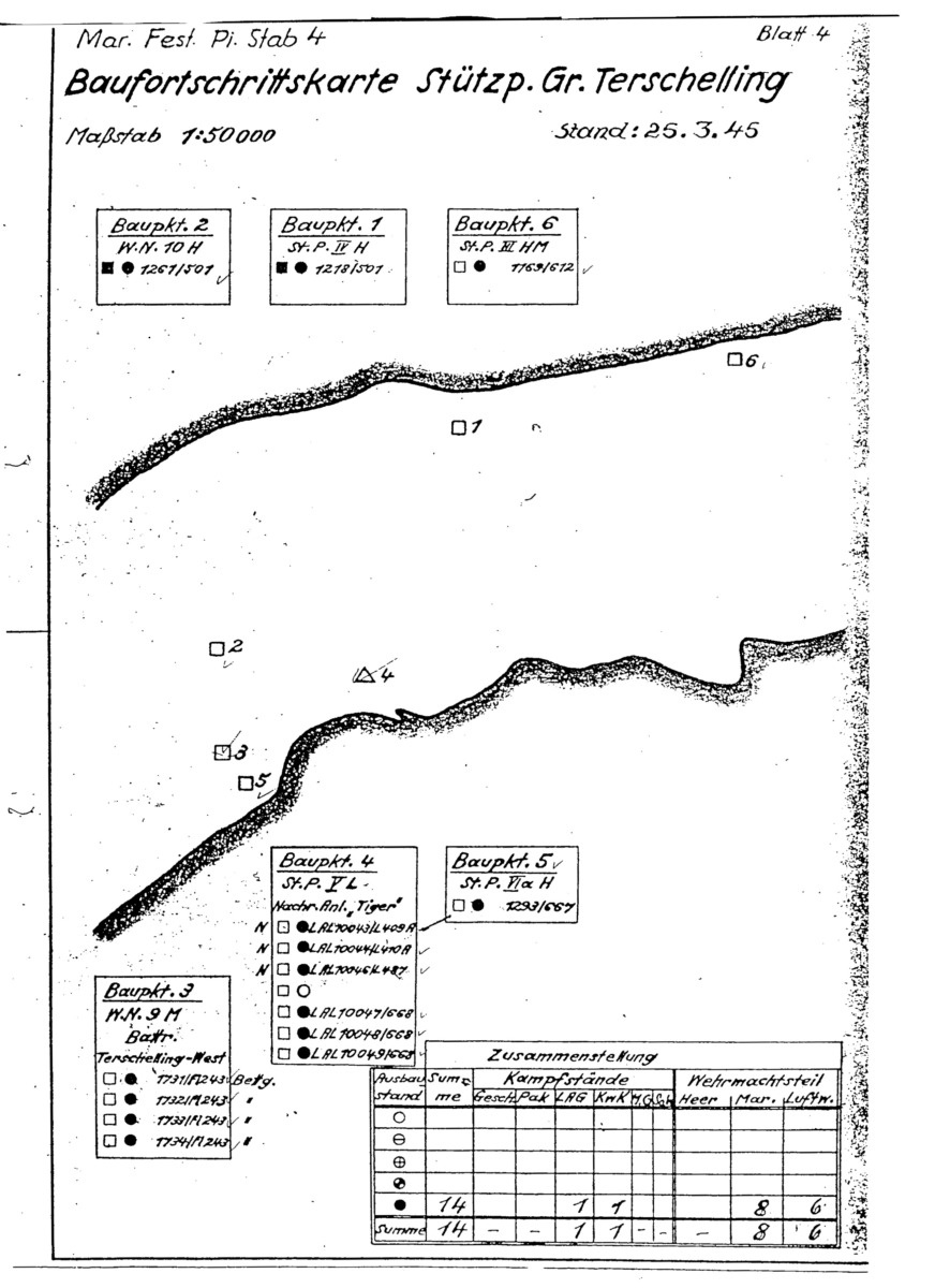
BFK Stützpunkt Gruppe Terschelling
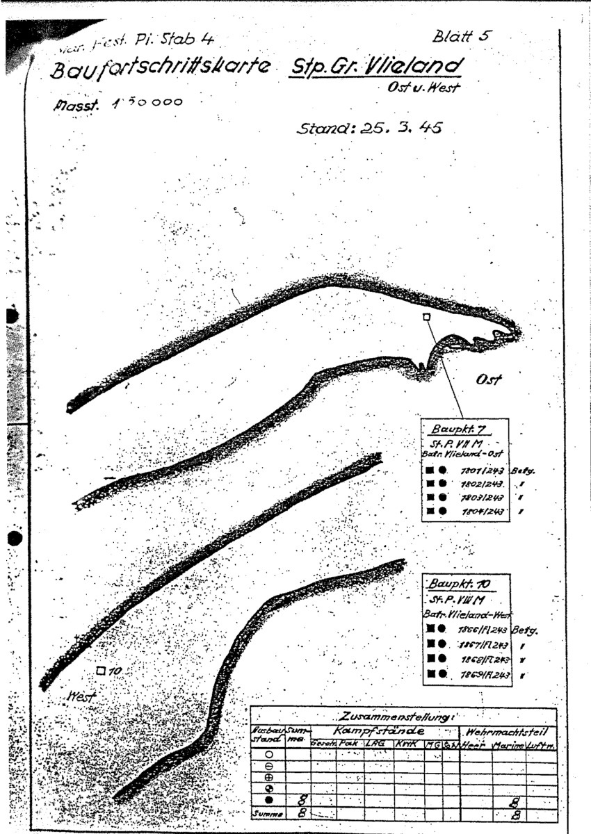
BFK Stützpunkt Gruppe Vlieland
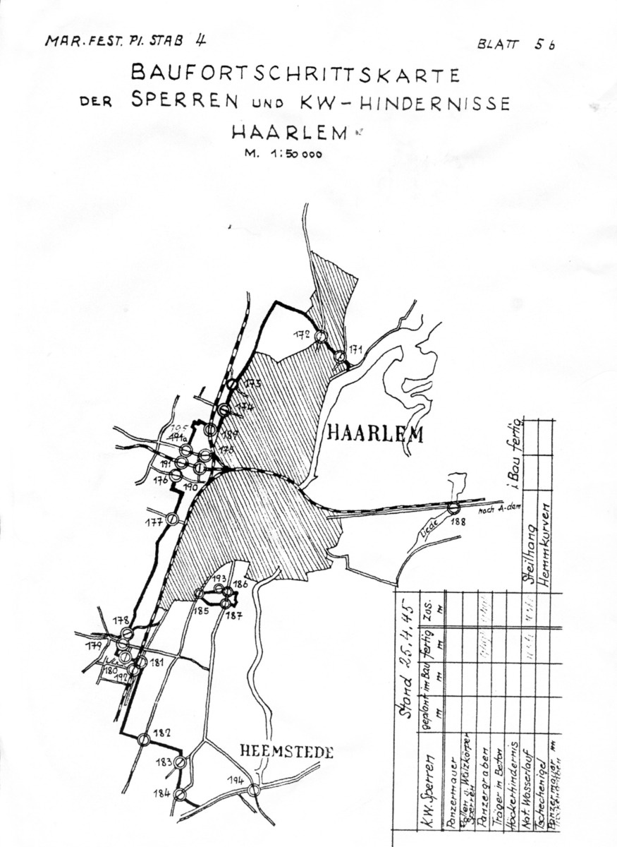
BFK Sperre und Kw-Hindernisse Haarlem
The bold black line marks the Anti-Tank moat (Panzergraben). The numbered dots indicate the access points where the Anti-Tank wall could be passed. At the crossings the defense line consisted of a heavy concrete wall (Panzermauer) or dragon teeth (Höckerhindernis). The dashed lines are railroad tracks.
BFK Stützpunkt Gruppe Texel
BFK Stützpunkt Gruppe Texel Süd
BFK Verteidigungsbereich Den Helder

BFK Den Helder Calantsoog
BFK Stützpunkt Gruppe Callantsoog
BFK Callantsoog Petten

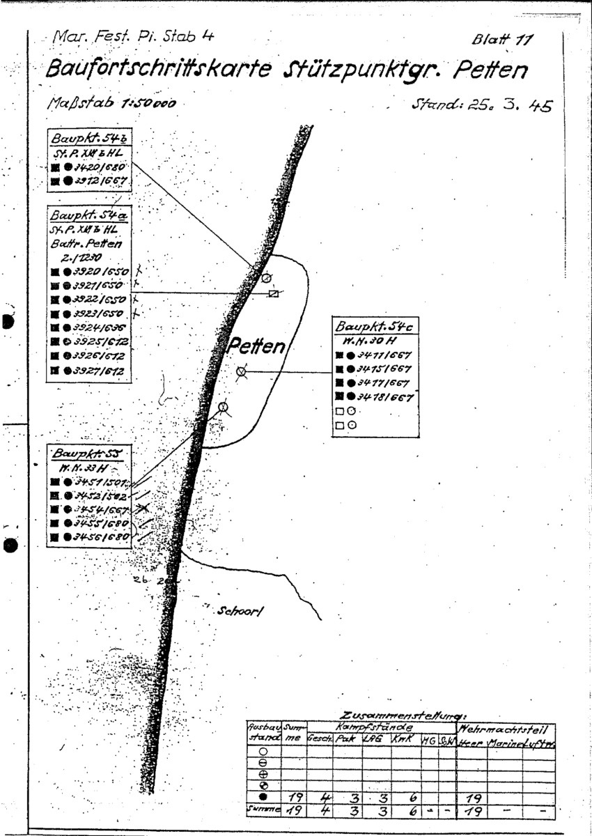
BFK Stützpunkt Gruppe Petten
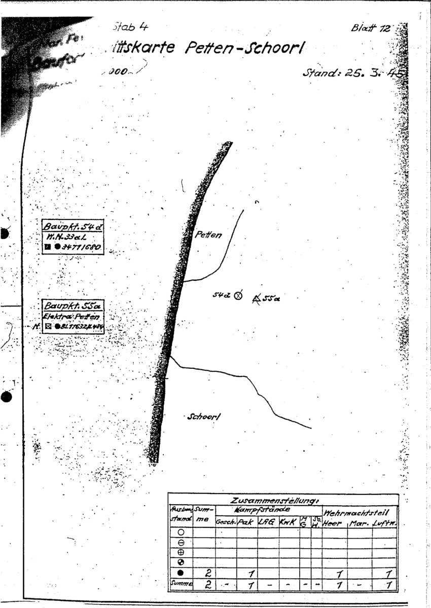
BFK Petten Schoorl
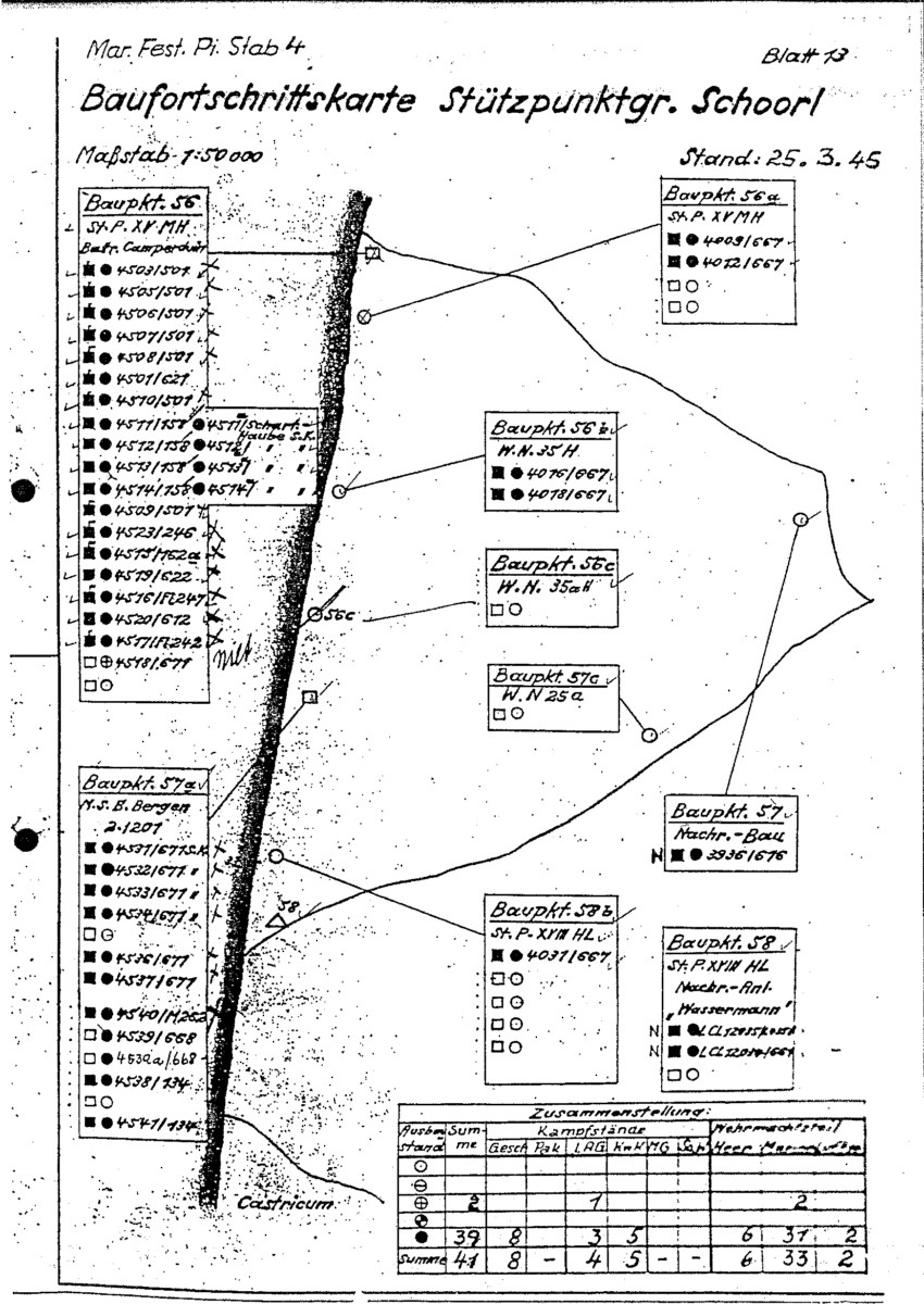
BFK Stützpunkt Gruppe Schoorl
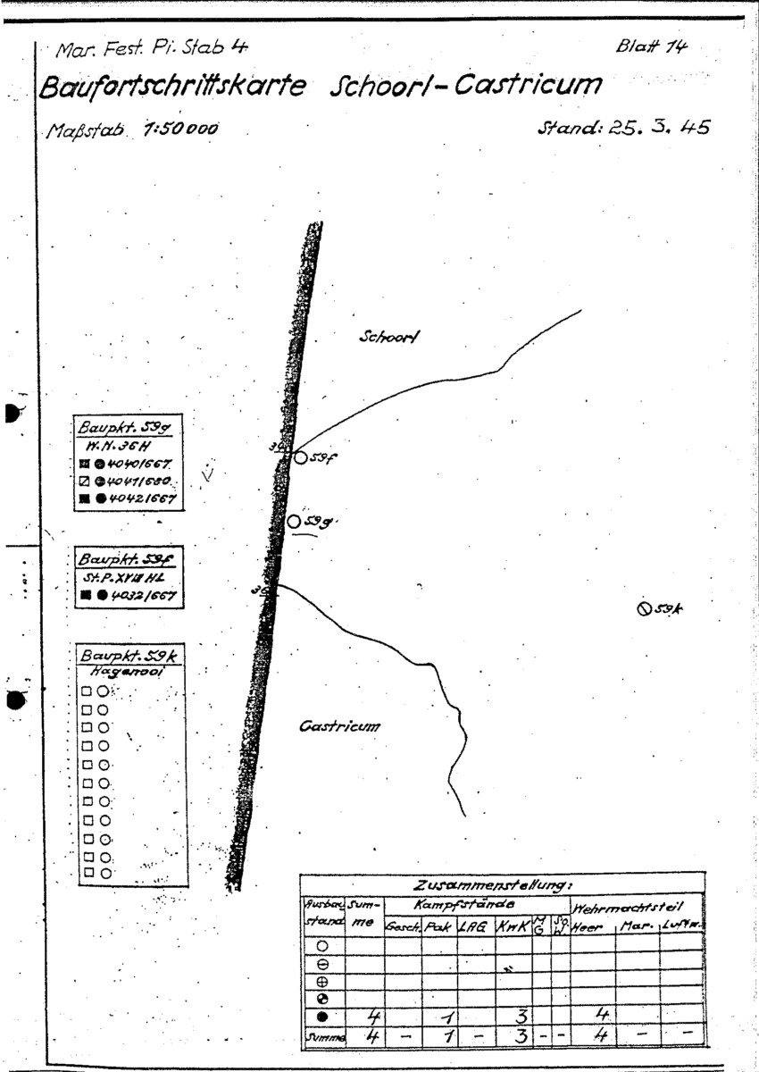
BFK Schoorl Castricum
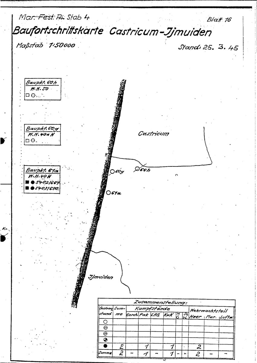
BFK Castricum IJmuiden
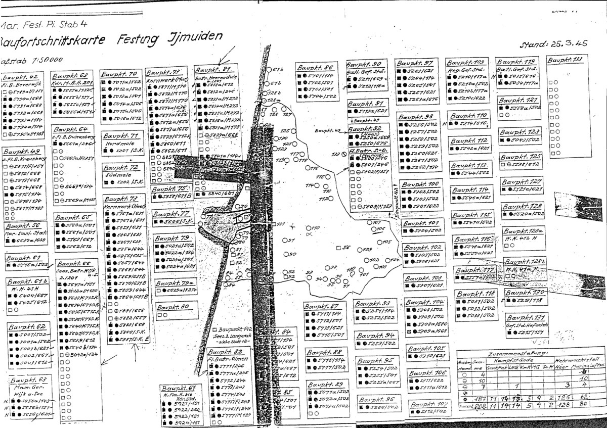
BFK Festung IJmuiden
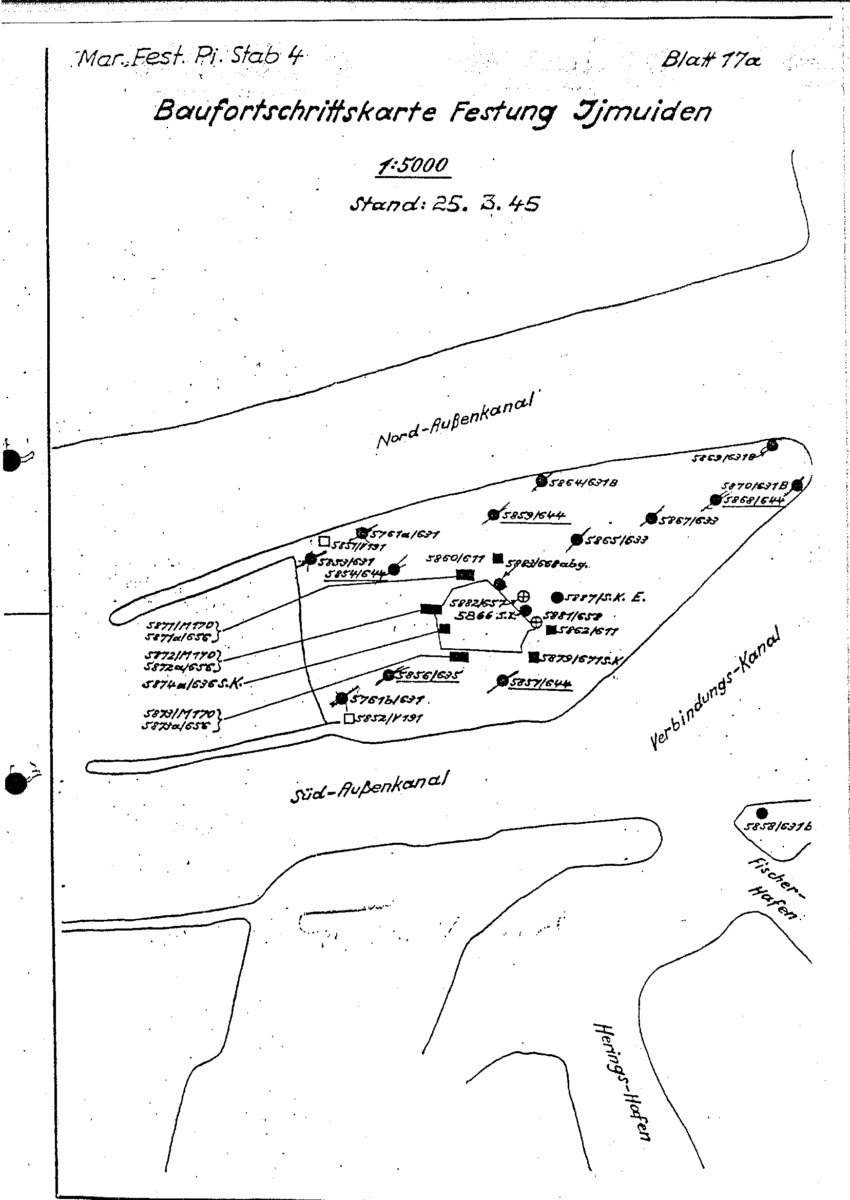
BFK Kernwerk IJmuiden
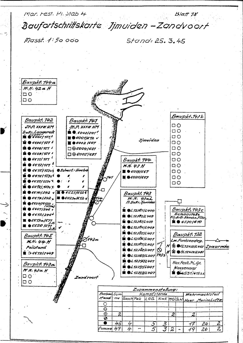
BFK IJmuiden Zandvoort
BFK Stützpunkt Gruppe Zandvoort

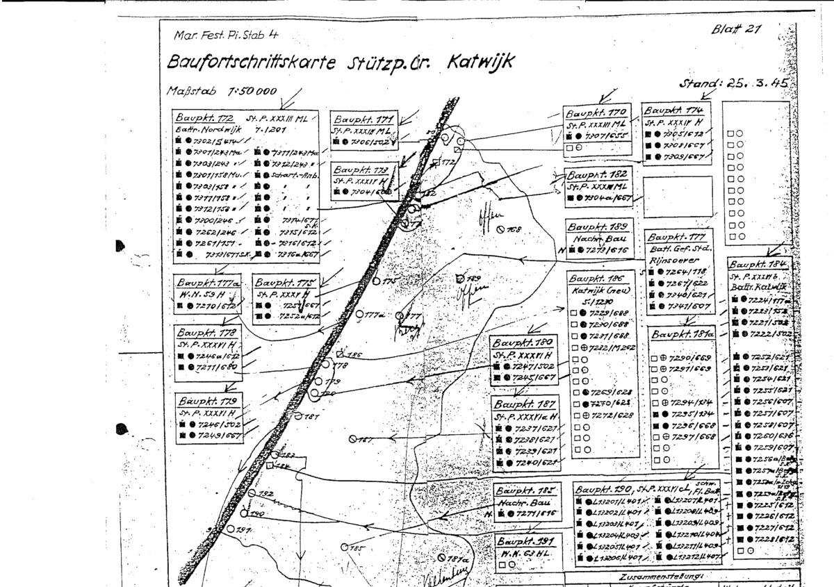
BFK Stützpunkt Gruppe Katwijk
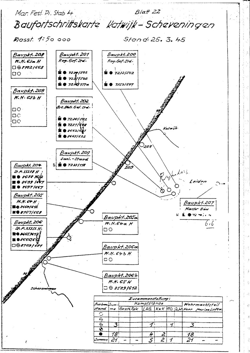
BFK Katwijk Scheveningen
BFK Stützpunkt Gruppe Scheveningen

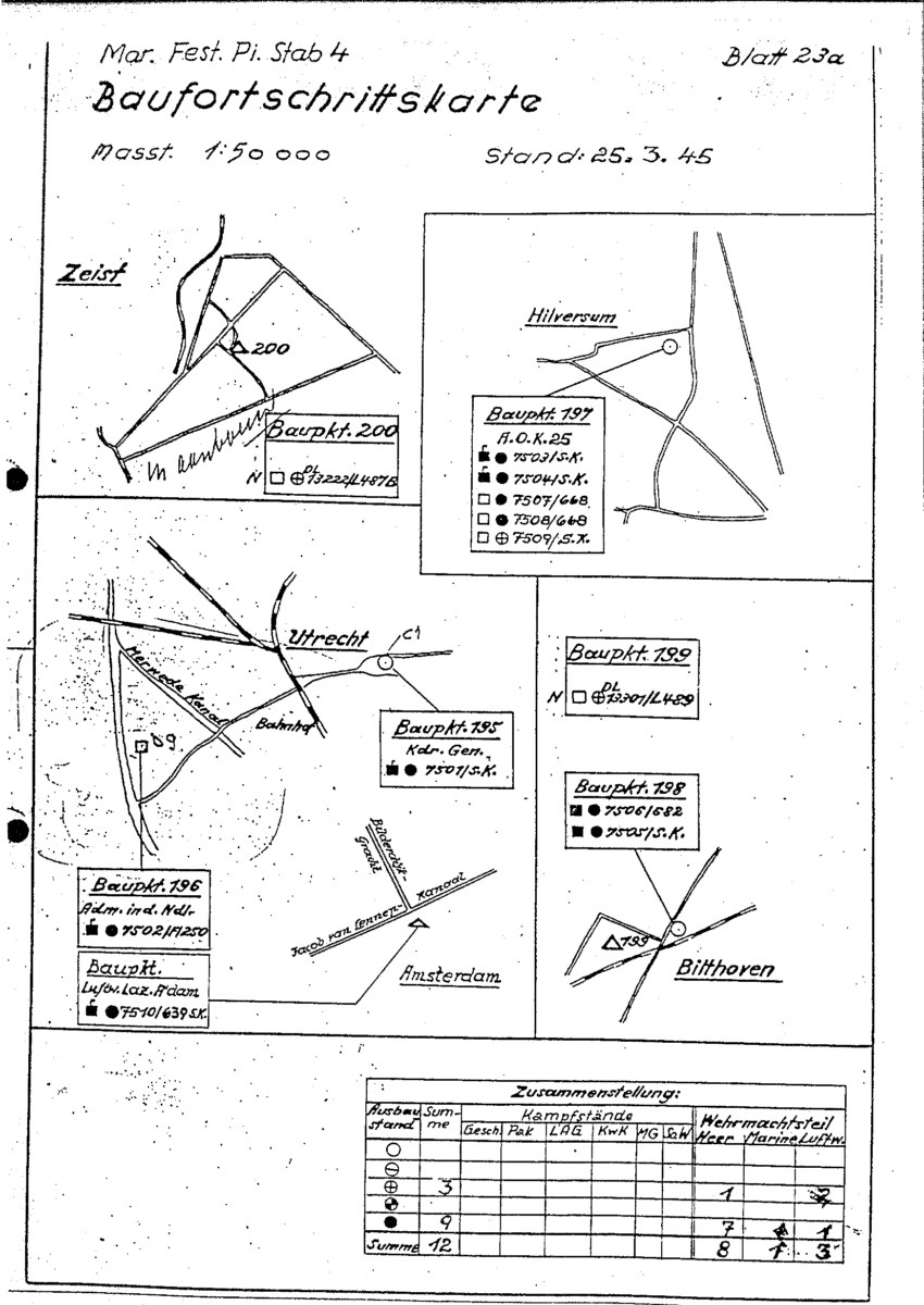
BFK Zeist Hilversum Utrecht Bilthoven
BFK Ter Heijde

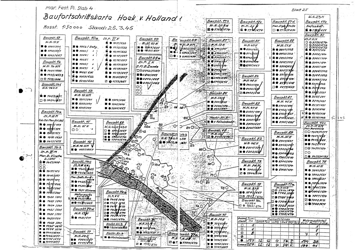
BFK Hoek van Holland
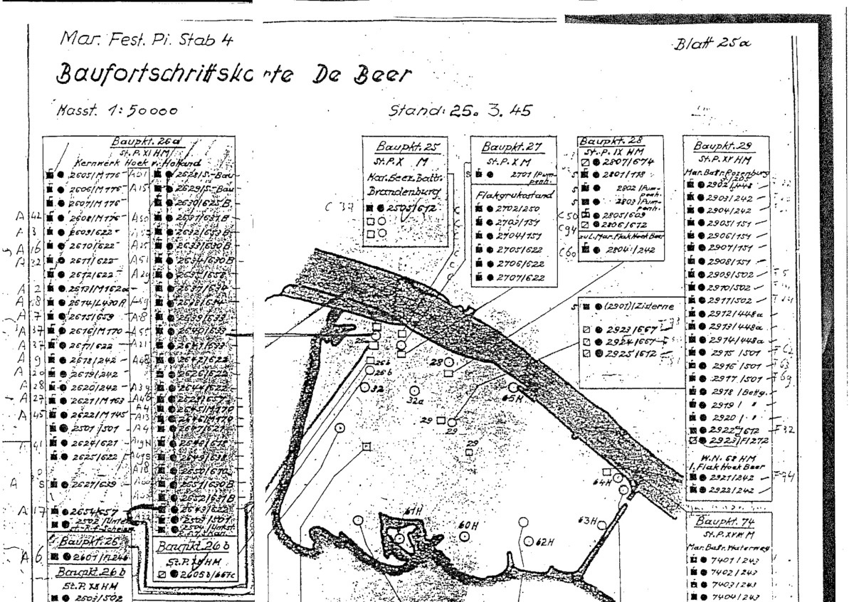
BFK De Beer
BFK Oostvoorne

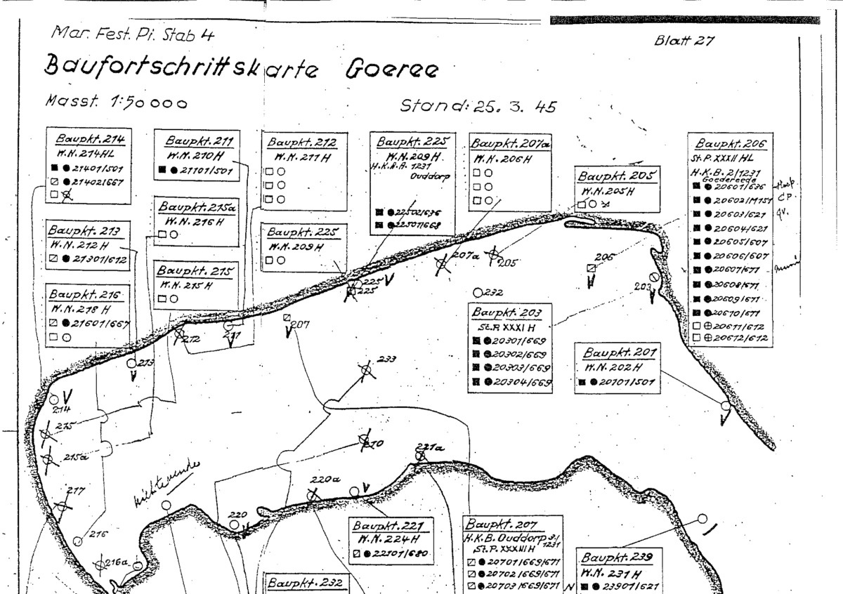
BFK Goeree
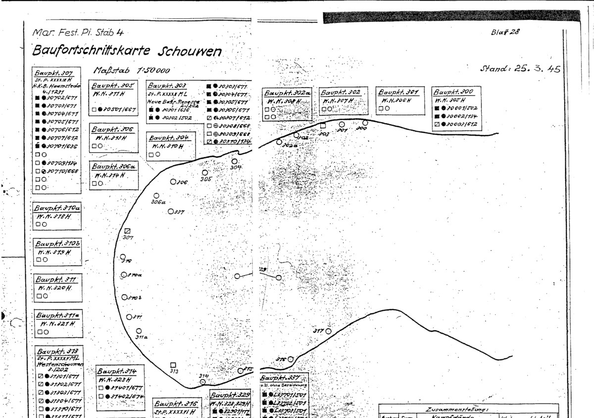
BFK Schouwen
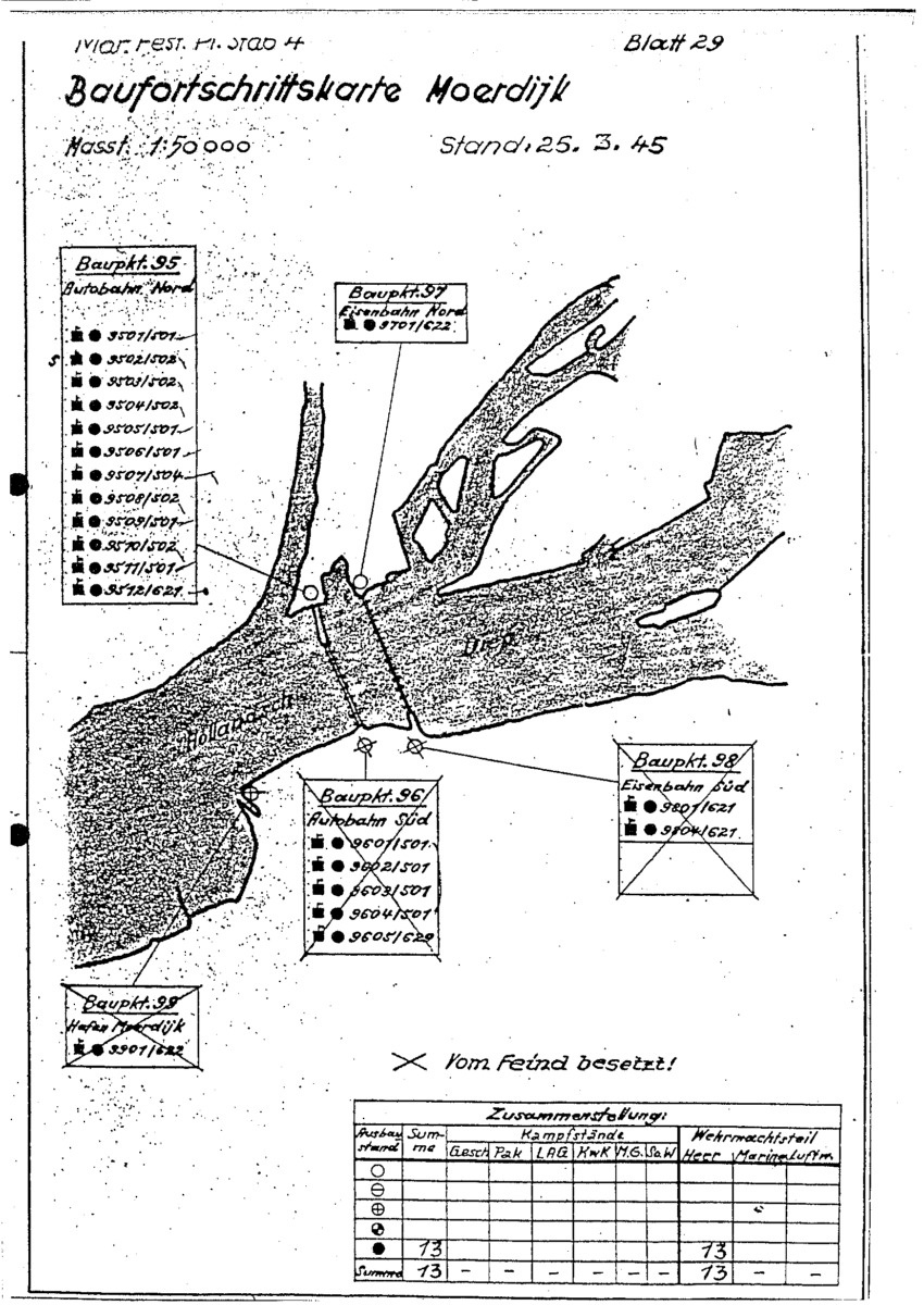
BFK Moerdijk
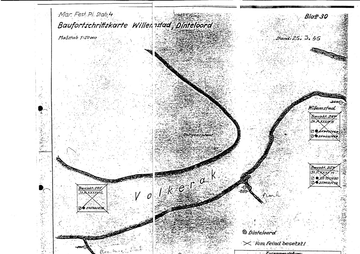
BFK Willemstad Dinteloord
BFK Sint Philipsland Tholen u. Eendracht-stellung

BFK Roosendaal Dordrecht

Marine Festungs-Pionier Gruppe Wassenaar
During WW2 this German Fortress Engineer unit was based in Wassenaar and Bloemendaal, The Netherlands. The Mar. Fest. Pi. Gruppe Wassenaar reports and maps focus more on the construction of Batteries.
BFK Flak Batterie Dünenberg WN.63

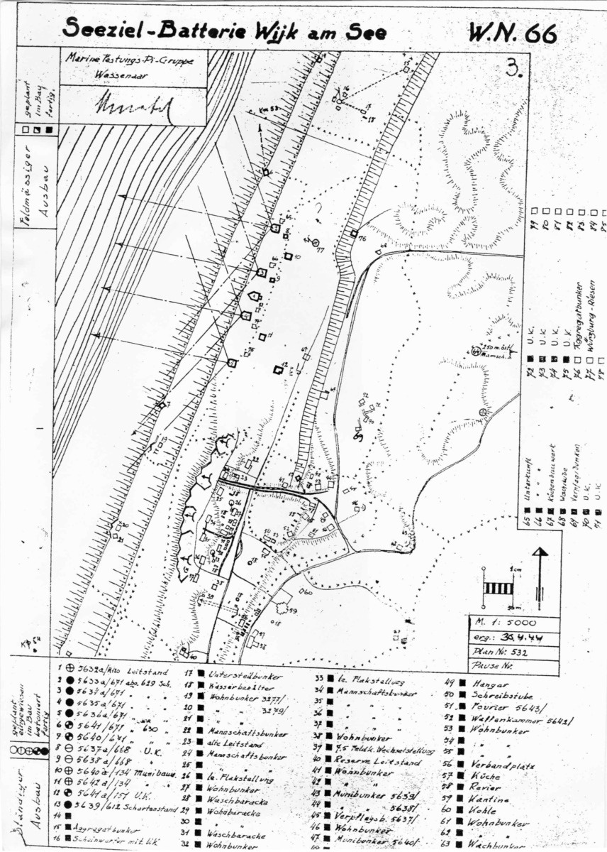
BFK Seeziel-Batterie Wijk am See Wn.66
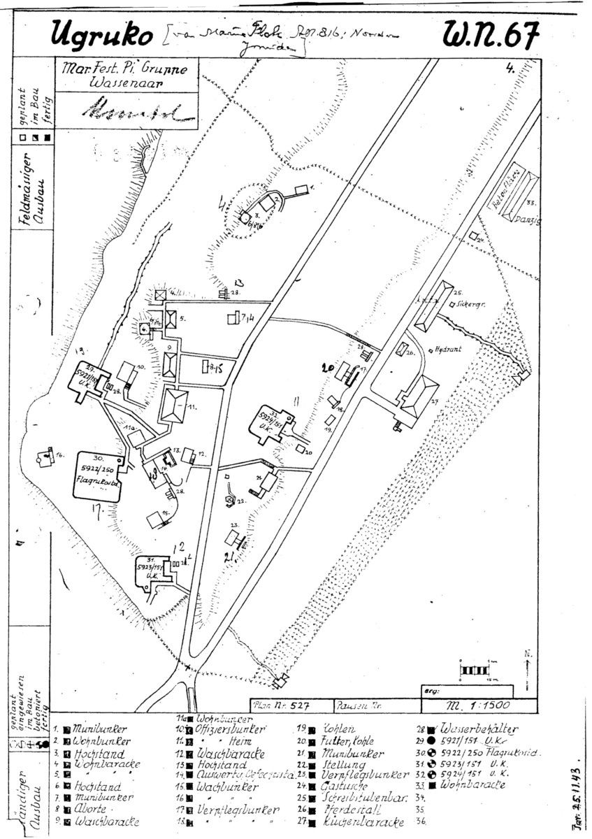
BFK UgruKo WN.67
The term “UgruKo” is the abbreviation of “Unter Gruppen Kommandostand”.
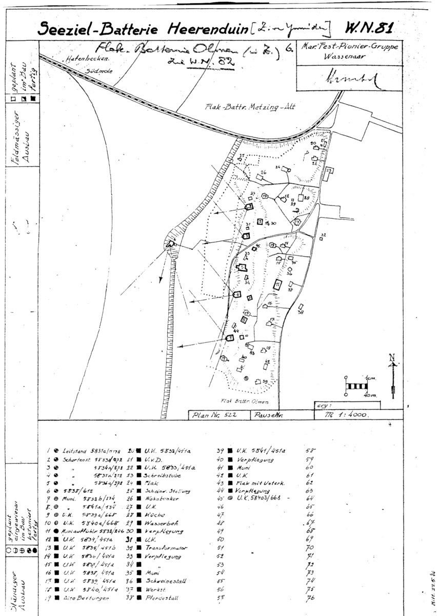
BFK Seeziel-Batterie Heerenduin IJmuiden Wn.81
Read more about Seeziel Batterie Heerenduin IJmuiden.
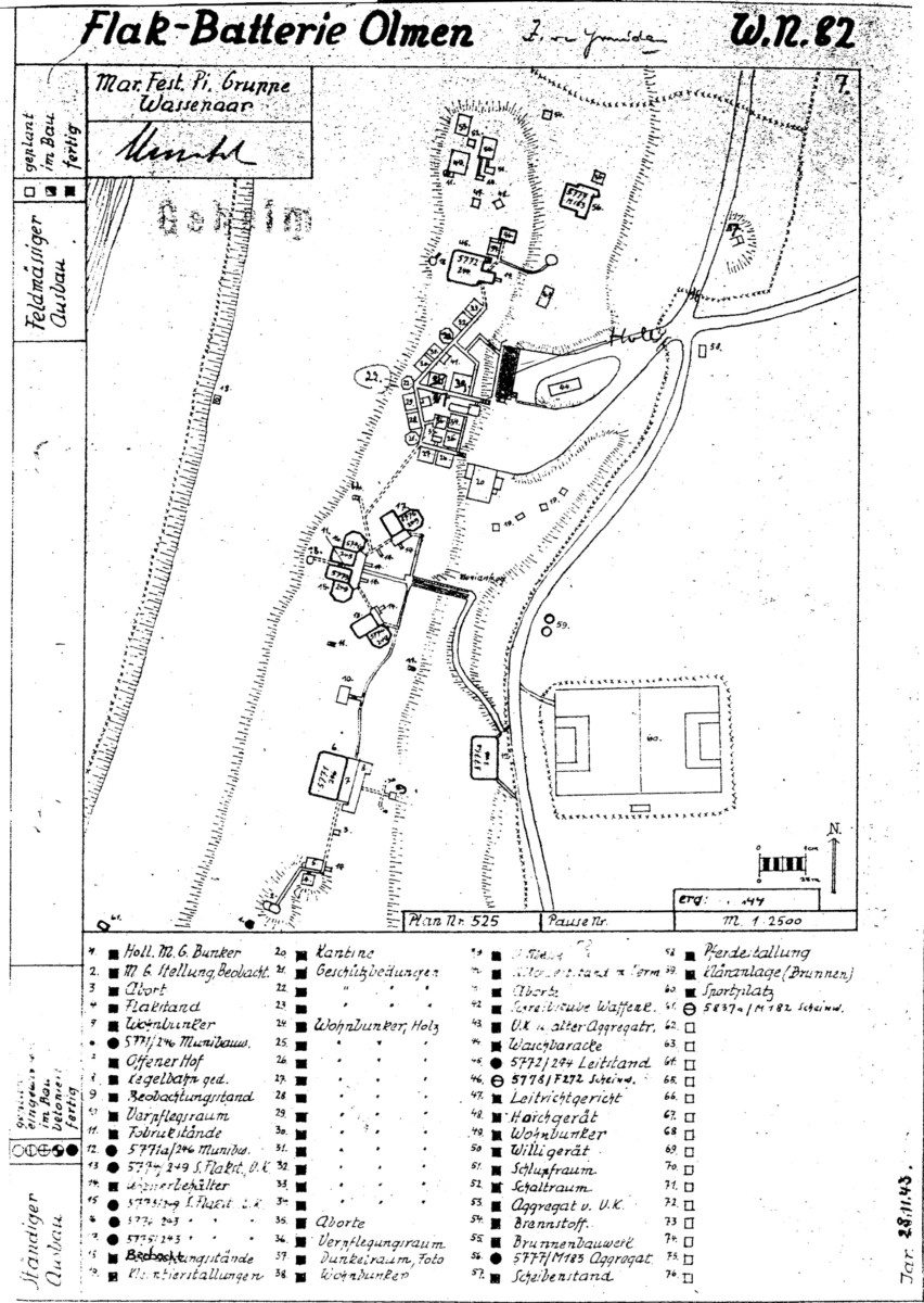
BFK Flak Batterie Olmen Wn.82
Read more about Flak Batterie Olmen.
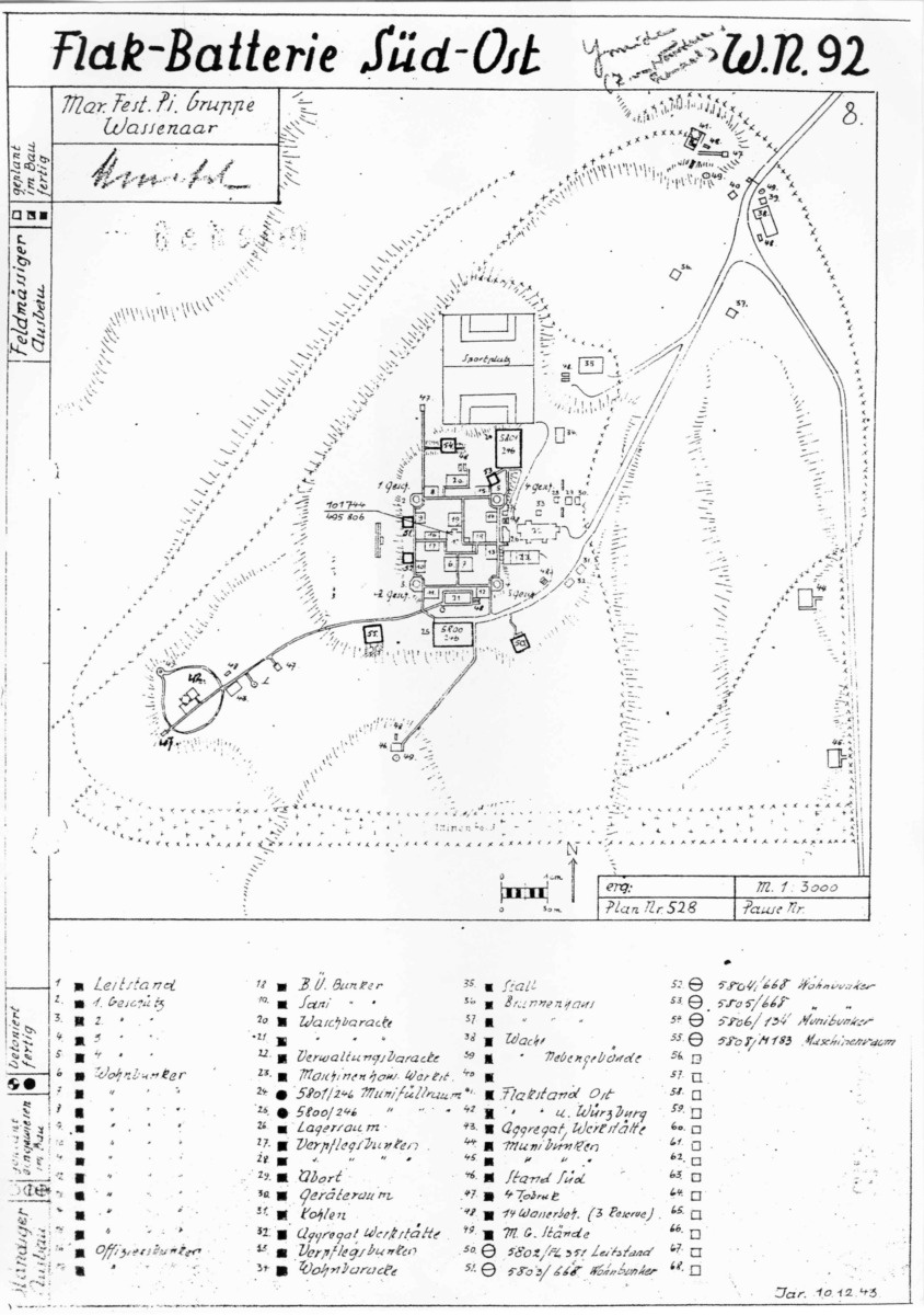
BFK Flak Batterie Süd-Ost WN.92
Read more about Flak Batterie Süd-Ost.
BFK Peilstand Langerak WN.157

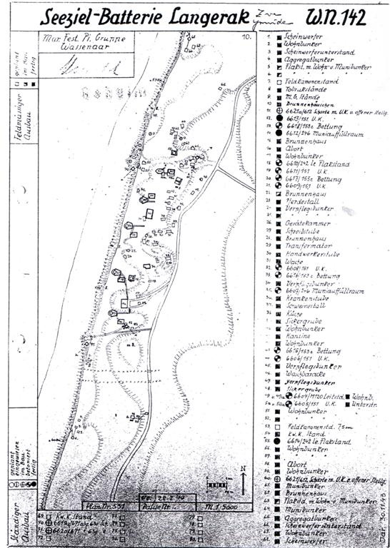
BFK Seeziel-Batterie Langerak WN.142
BFK Flak Batterie Bhf. Beverwijk WN.43

BFK Seeziel Batterie Noordwijk Stützpunkt XXXIII M

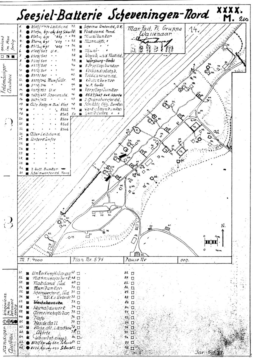
BFK Seeziel Batterie Scheveningen-Nord Stützpunkt XXXX M
BFK Seeziel Batterie Westduin Stz.P. XXXXIV M

BFK Mammutanlage Stz.P. 66H
Extra note on top right of the report reads: ‘sGravenhage (The Hague) Vogelbuurt, 223.

BFK F.d.S.
The “F.d.S.” abbreviation stands for “Führer der Schnellboote”. The map shows the complex of the Navy command.

BFK HKB Katwijk-Neu Stützpunkt 59H

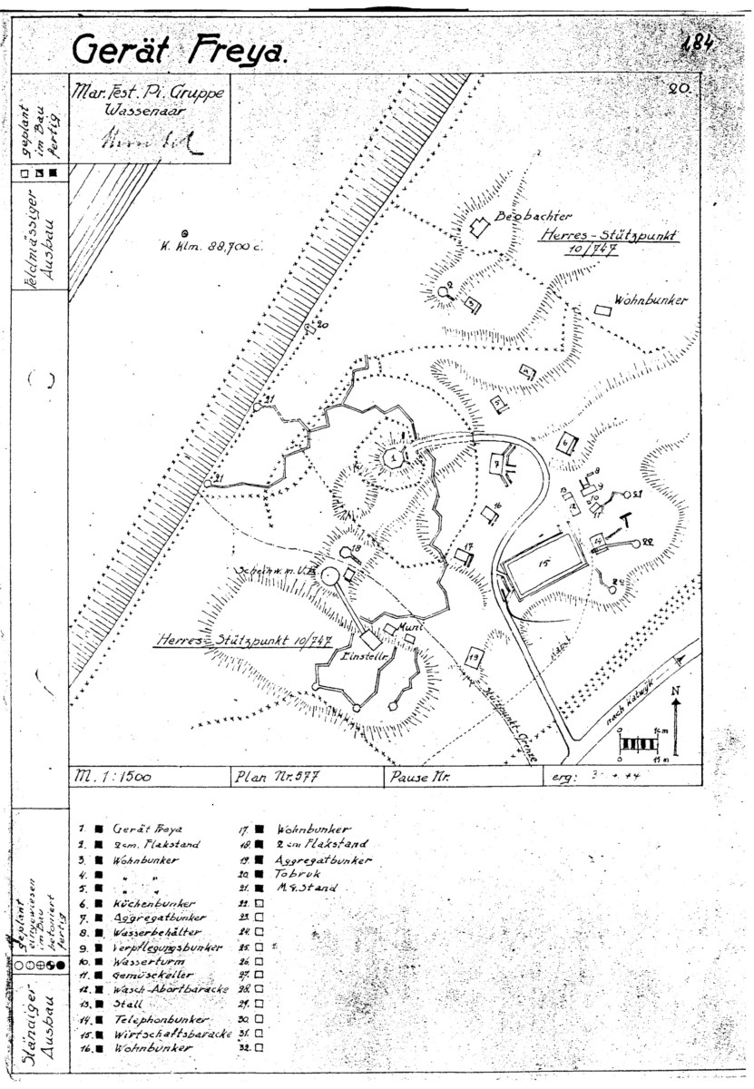
BFK Gerät Freya
BFK HKB Katwijk-Alt Stützpunkt XXXVI bH

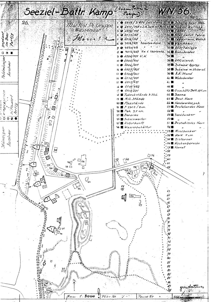
BFK Seeziel Batterie Kamp WN.56
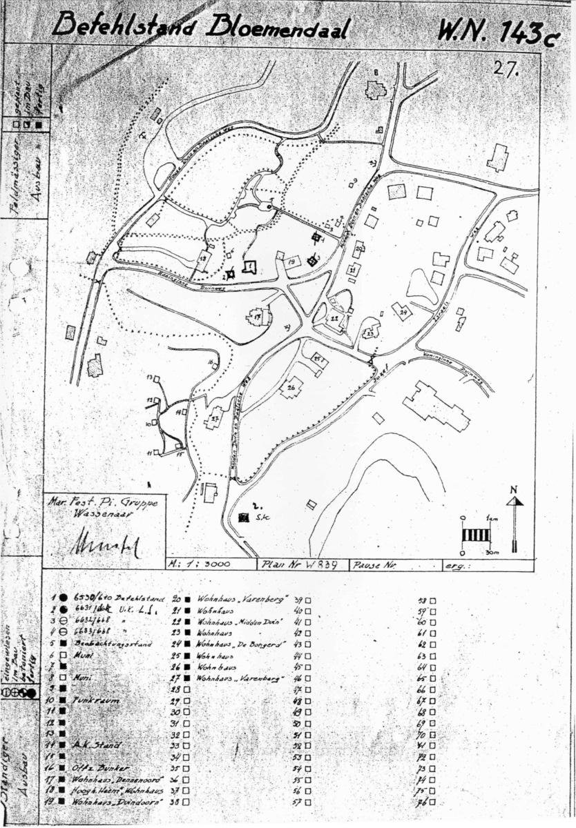
BFK Befehlstand Bloemendaal WN.143c
This is the command post of the Coastal Artillery or in German “Küstenartillerieführer”.
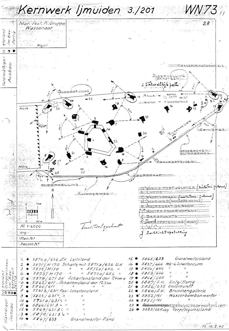
BFK Kernwerk IJmuiden Wn.73
Read more about this Fortress Island of IJmuiden.
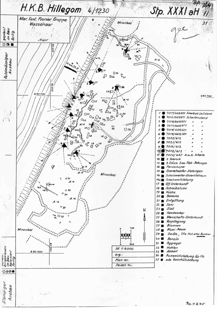
BFK HKB Hillegom Stzp. XXXI aH
BFK HKB Castricum Stützpunkt XXII H

BFK Seeziel Batterie Egmond am See Stzp. XIXM

BFK Flak Batterie Metzing-Alt WN.80

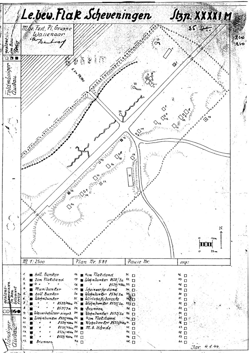
BFK Le. Bew. Flak Scheveningen Stützpunkt XXXXI M
Stellungsbaukarte
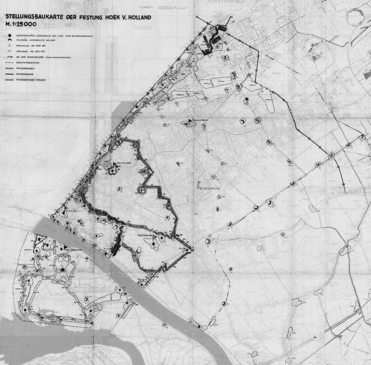
SBK der Festung Hoek van Holland
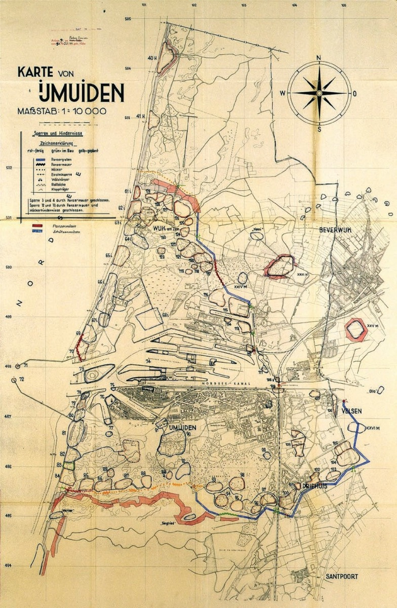
SBK IJmuiden
Map of Festung IJmuiden marking “Sperre und Hindernisse” (Eng: blockades and obstacles). The German map legend indicates; red is finished, green is under construction and yellow is planned.
Legend
| Abbreviation | | Meaning |
|---|---|
| Battr. | Batterie |
| BFK | Baufortschrittskarte |
| F.d.S. | Führer der Schnellboote |
| HKB | Heeres Küstenbatterie |
| MKB | Marine Küstenbatterie |
| Stz.P. | Stützpunkt |
| UGruKo | Unter Gruppen Kommandostand |
| WN | Widerstandsnest |
Hi, you have an amazing site concerning Atlantic wall documents. I was wondering where did you get the Baufortschrittskarte from? I’m looking for specific numbers (92 to 97) in the Netherlands but the Netherlands national archive, budesarchive and the US national archive don’t have these. Can you recommend a source?
Kind regards,
Chris
Hi Chris,
We have gathered here what was shared with us or what was available circulating on the internet for our own research. We wanted to make them more accessible to an international audience.
Most of these documents come from the archives of the Dutch Bureau Registratie Verdedigingswerken (BRV), which was an organisation established by the Dutch Army after WWII with the tasks of mapping, measuring and drawing German defences in the Netherlands.
The drawings and information collected by the B.R.V. is very extensive, but can be incomplete. Some of the fortifications that were already demolished or covered by sand went unnoticed during the inventories.
The archive of the BRV is part of the Dutch National Archives.
I can also recommend https://www.fortificatieforum.nl/. Although this is a Dutch forum, it is a great source of information about the subject and to connect with the bunker community if you have any questions.
If you find them, we would appreciate it if you would share them with us of course ;)
Pascal